![]()
The table below presents some of the fields of the "Uniformed" National Reports that can be "numerized". The three major field categories that we come across are the following:
| Field |
Type | Width |
Definition |
| Area | N | 10 | Country area |
| Population | N | 10 | Country population |
| Education | N | 1 | Level of education of SDI specialists (1-5) |
| Internet
Access | N | 2 | Internet access of local population (%) |
| Publications | N | 3 | Number of National SIM publications |
| Necessity | B | 1 | Is NSDI necessary for sustainable Land Administration? (y/n) |
| Agency | B | 1 | Is there a responsible Agency for NSDI implementation? (y/n) |
| Policy | B | 1 | Does an established policy on SIM development exist? (y/n) |
| Laws | B | 1 | Does legislation on SIM exist? (y/n) |
| Associations | N | 2 | Existence of National GIS/SIM associations |
| Infrastructure | N | 1 | Level of SIM infrastructure (1-5) |
| Availability | N | 1 | Level of availability of SIM data on the Internet (1-5) |
| International | B | 1 | Co-operations, support, international project exist? (y/n) |
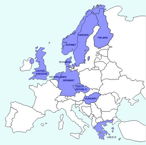
This way, every information provided can come visual. An example of the Continent of Europe is presented differentiated on whether a Country's National Report exists on the WG3.3 Web-Site or not.
![]()