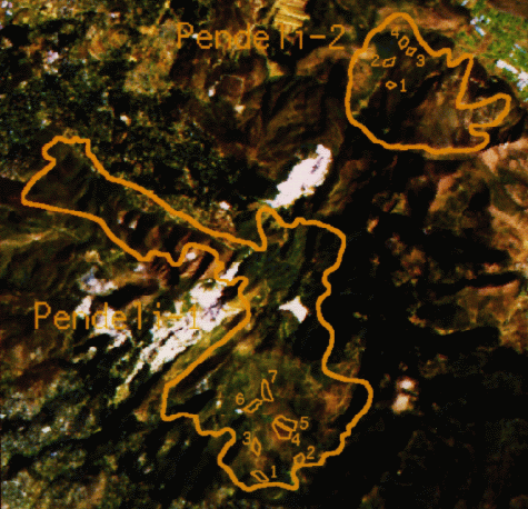
LANDSAT  DATA  SET  SUMMARIES 

Data Title Estimation of Biomass, Burn Severity and Carbon Efflux in Alaska
Data Type Raster image maps of black spruce biomass, burn severity and carbon efflux
Data Sensor Landsat TM
Geographical Region Alaska
(within approximately 63°52'20''N to 63°43'40''N, 145°16'14''W to 144°57'58''W)
Time Period 30 August 1992 and 16 September 1995
Data Originating Center Environmental Research Institute of Michigan (ERIM)
PO Box 134001,
Ann Arbor, MI 48113-4001,
USA.
Authors and Contacts Jeffrey L. Michalek
Eric Kasischke
Data Illustration/Demo
Gerstle River, Alaska. Carbon Release Map for Burned Black Spruce

Full Documentation

Data Title Vegetation Regeneration in Greece
Data Type Burnt area mapping
Data Sensor LANDSAT TM
Geographical Region The study concerns four regions Greece (Attica area): Barnabas, Pateras, Lavrio and Penteli
Time Period Image dated 14 September 1993
Data Originating Center CVSSP
School of Electronic Engineering
IT and Mathematics
University of Surrey
Guildford
Surrey GU2 5XH
UK.
Authors and Contacts Maria Petrou
D. Rokos
Cliff Banninger
Data Illustration/Demo
Four main fire affected regions of Attica, Greece
Barnabas Lavrio Pateras Penteli
Full Documentation

Data Title Burned Area Maps of Portugal
Data Type Burnt area mapping
Data Sensor Landsat TM
Geographical Region Portugal
(within approximately 37.5°N to 43°N, 9.5°W to 6.5°W)
Time Period 1991 to 1994
Data Originating Center Remote Sensing and Geographical Analysis Laboratory of DEF/ISA
TAPADA DA AJUDA
1300 Lisboa
Portugal
Authors and Contacts José M.C. Pereira
João M.N. Silva
Adélia Sousa
Data Illustration/Demo
One of the largest fires in Portugal in the recent years, overlaid on a digital terrain model of the area

Burned Area Maps
1991 1992 1993 1994
  • Perimeters of burned areas in red
  • Frontiers in black
  • Cities in green
Full Documentation

Data Title Investigating Fire Occurrence in Northern Botswana
Data Type Burnt area mapping
Data Sensor LANDSAT MSS
Geographical Region Northern Botswana (Chobe National Park), between 18°00'S and 18°58'S, 23°52'E and 24°55'E
Time Period 1972 to 1991
Data Originating Center Laboratory for Forest, Nature and Landscape Research
Institute for Land and Water Management
Katholieke Universiteit Leuven
Vital Decosterstraat 102
B-3000 Leuven
Belgium
Authors and Contacts Suzanne Serneels
Hubert Gulinck
Data Illustration/Demo
Fire scar pixel (black) over Chobe National Park
1 September 1972 29 November 1991
Full Documentation