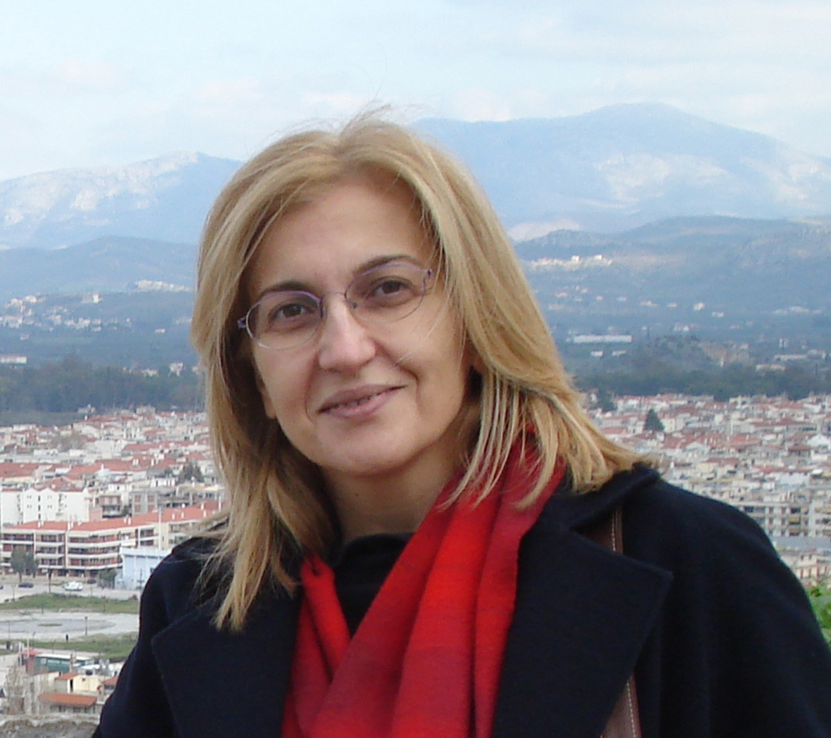
| Chryssy Potsiou |
 |
|
|
Personal Data Name : Chryssy Family Name : Potsiou Date of Birth : 16 January 1959 Place of Birth : Athens Nationality : Greek Status : Married to Prof Ioannidis Charalampos, NTUA Position : Associate Professor NTUA E mail : chryssyp@survey.ntua.gr; chryssy.potsiou@gmail.com website : http://www.fig.net/council/vicepresident_potsiou_11_14.htm
Studies Degrees & thesis June 1976 Graduated from Arsakeio Psychikou (High School) with a rate 18 1/3. September 1976 She entered the School of Rural and Surveying Engineers of AUTH after successful examination September 1977 She was transferred to the 2nd academic year at the School for Rural and Surveying Engineers of NTUA after successful examination; rate: excellent (2nd in 70 students) March 1982 she graduated from the above school with rate: 7.66 (3rd in her class). Her diploma thesis was titled”Analytical photogrammetric restitution using Stereocord-G2”, rated: excellent (10). June 1995 she completed her PhD at NTUA; titled: “Digital Cartographic Data for the Hellenic Cadastre”. June 2006 She attended the following MIT (Massachusetts Institute of Technology) professional education courses on Real Estate Markets Center for Real Estate: - Fundamentals of Real Estate Finance - Real Estate Markets: Location, Product, Timing - Introduction to Commercial Real Estate Development. Languages
English: Proficiency in English, Cambridge. German: Mittelstufe level, Goethe Institut.
Scholarships
1976 Scholarship for her graduation rates at High School (National Insurance). 1977 Schlarship from AUTH for her rates in the first year. 1980-81 Scholarship from the TCG for her rates. 1982 Scholarship for her university graduation rates (National Insurance). Teaching Activity
University teaching
Since 1983 she participated in NTUA teaching activities especially she carryed out the exercises and gave lectures in all courses offered by the Lab of Photogrammetry. Since 1992, according to secretariat records, she has participated in the following undergraduate courses: - Cadastre, - Photogrammetry Ι, - Digital photogrammetry, - Summer courses in photogrammetric practice, - General cartography, - Archaeological surveys, - Cadastre and LIS, - Modern photogrammetry, - Photogrammetry ΙΙ, - Topography for Architects.
Since she became Lecturer she has self-reliant teaching activity, in the following undergraduate courses in the School for Rural & Surveying Engineers (SRSE) NTUA: - ‘Cadastre’, obligatory course of the 7th semester of the undergraduate programme of the School for RSE, - ‘Cadastre and LIS’, optional course of the 8th semester of the undergraduate programme of the School for RSE, - ‘Real Estate Valuation & Land Management’, optional course of the 8th semester of the School for RSE, - ‘Development and Management of Land Administration Systems’, problem-based course of the 9th semester.
She also has self-reliant teaching activity in the post graduate course offered by the postgraduate programme “Geoinformatics”, offered by NTUA: - ‘Real estate valuation –real estate development’, course of the 2nd semester.
She was an invited lecturer at the masters programme “Land Management and Land Tenure” of the Technical University of Munich, on the topic “Informal Development in Europe”, in 2010 http://www.landentwicklung-muenchen.de/master/index.html
Supervision of Diploma Theses
Since autumn 2005 (after she became a Lecturer) until today, she has been officially responsible for the supervision of 36 diploma theses in total: 32 of the undergraduate programme of the School for RSE and 4 at the postgraduate programme “Geoinformatics” offered by NTUA. She has participated in the supervision and examination of several other diploma theses as well.
Supervision and examination of PhD theses
Supervision of PhD theses
She currently supervises the following 4 PhD theses: - Sofia Basiouka, titled: «Development of a Model for integration of volunteered geographic information VGI into cadastral databases» (decision oof GA of SRSE 6/10/2010) - Christina Alexiadi, titled «BIM – Building Information Modelling» (Decision of General Assembly of the SRSE 7/6/2012) - Maria Filippakopoulou, in the field of «Real estate valuation and Land Management» (accepted by the GA in June 2012; the exact title of her PhD has not yet been defined yet) - G. Mourafetis, in the field of Cadastre (has not been defined yet)
Examination of PhD theses in Greece
She has been examiner (in a 7-member examination committee) of 4 PhD theses, todate. - Κ. Daniilidis, July 2007. titled: «Transaction management in a land administration system- Fochal algorithm» (Supervisor: Prof P. Zentelis), SRSE NTUA. - Ν. Androulakakis, June 2010. «Interoperability in GIS education for Adults – Software for distant learning» (Supervisor: Professor Κ. Κoutsopoulos), SRSE NTUA. - S. Μisirloglou, June 2011. «Modelling the management of the urban municipal cadastre» (Supervisor: Professor Α. Αrvanitis), Department of Rural and Surveying Engineers (DRSE) AUTH. - Ε. Ilia, January 2012. «Operation and development of cadastral systems-Structuring and implementation of a model for state property management in Cyprus» (Supervisor: Professor P. Zentelis), SRSE NTUA.
Examination of PhD theses in foreign universities
She was external examiner for the following 2 PhD theses: - H. Mohammadi, June 2009. ‘The Integration of Multi-source Spatial Datasets in the Context of SDI Initiatives’. Centre for Spatial Data Infrastructures and Land Administration, Department of Geomatics, Faculty of Engineering, The University of Melbourne, 245 p. - Muyiwa Agunbiade, December 2012. ‘Land Administration for Housing Production’. Centre for Spatial Data Infrastructures and Land Administration, Department of Infrastructure Engineering, The University of Melbourne, 293 p.
Course material and Teaching notes
- Digital photogrammetric systems, 1992, 20 p (co-author C. Ioannidis) Chapter (9th) of the notes for the optional course «Digital photogrammetry» of the 9th semester of SRSE NTUA. - Photogrammetric hardware and software – Adjudication of owners for the cadastre, 1994, 41 p. Chapters (8th and 9th) of the notes for the seminar titled «Cadastre and LIS», organized for the 4th programme for capacity building in NTUA, 5 – 14 December 1994, scientific responsibility: Professor P. Zentelis. - Digital spatial data collection – photogrammetric restitutions using CAD, 1995, 18 p. Special chapter for the seminar notes for «cadastre and LIS», organized in October-November 1995, scientific responsibility: Professor P. Zentelis. - International trends and developments of cadastral systems, 1998, 10 p. Additional notes for the obligatory course «Cadastre» of the 7th semester SRSE NTUA. - Cadastre and land administration in the European region– trends and principles, 2005, 15 p. Additional notes for the optional course «Cadastre and LIS» of the 8th semester SRSE NTUA - Land and land administration, 2005, 19 p. Slides for the optional course «Cadastre and LIS» of the 8th semester SRSE NTUA - Current trends: e-Government) and e-Land Administration, 2006, 21 p. Additional notes for the optional course «Cadastre and LIS» of the 8th semester SRSE NTUA - The social and economic benefits of cadastre and land administration, 2006, 7 p. Additional notes for the optional course «Cadastre and LIS» of the 8th semester SRSE NTUA - Cadastre and National economy: Property valuation, property taxation, property markets, 2008, 20 p. Additional notes for the optional course «Cadastre and LIS» of the 8th semester SRSE NTUA - The marine cadastre, 2008, 42 p. Additional notes for the optional course «Cadastre and LIS» of the 8th semester SRSE NTUA.
- Informal development in Greece: Land management and National Cadastre, 2010, 64 p. Slides for the problem-based course on «Development and management of land administration systems» of the 9th semester SRSE NTUA - The real estate and its valuation – The nature of value, Supply and Demand – Information Systems for property valuation, 2011, 26 p. Slides for the optional course «Real estate valuation & Land management» of the 8th semester SRSE NTUA. - Cadastre and climate change, 2011, 21 p. Additional notes for the optional course «Cadastre and LIS» of the 8th semester SRSE NTUA - Land consolidation: a tool for land management, 2012, 36 p. Slides for the obligatory course «Cadastre» of the 7th semester SRSE NTUA - The European and international approach for obligatory land expropriation – Obligatory land expropriation in Europe and in Greece, 2012, 17 p. Additional notes for the obligatory course «Cadastre» of the 7th semester SRSE NTUA
Seminar Lectures
Lecture: “Analytical photogrammetric restitutions” · Capacity building seminar for unemployed engineers, organized by the TCG, December 1993, titled «Digital processing of airphotos and remote sensing images». Lecture: “Digital orthophoto and mosaics” · Capacity building seminar, organized by NTUA in 1994, titled «Cadastre and LIS» (scientific responsibility: Professor P. Zentelis). Lectures: ‘Photogrammetric hardware and software for the cadastre’ ‘Procedure for the adjudication of owners’. · Capacity building seminar, organized by NTUA, titled: «Archaeological surveys», 7/11-16/12/1994 (scientific responsibility: Prof J. Badekas and Prof D. Zivas). Lectures: ‘Photogrammetric instruments’, ‘Analog stereorestitution’ and ‘Analytical stereorestitution’. · Capacity building seminar, organized by NTUA titled «Cadastre and LIS» (scientific responsibility: Prof P. Zentelis), October-November 1995. Lectures: ‘Procedure for adjudication of owners’, ‘Digital spatial data collection’, ‘hardware and software’ and ‘Analytical photogrammetric restitution in urban areas’. · Seminar titled «Cadastre and LIS» for the engineers of Cyprus, organized by NTUA and the Technica Chamber of Cyprus (scientific responsibility: Prof P. Zentelis), 3-6 February 1999. Lecture: ‘Current trends and developments in land administration – Cadastral systems in Europe’. · Capacity building seminar for unemployed engineers organized by ΙΕΚΕΜ-ΤΕΕ the Technical Chamber of Greece, titled «GIS and applications in Greece», 1/2/1999 – 17/5/1999, of 350 hrs (scientific responsibility: Prof P. Zentelis and Dr Chryssy Potsiou). Lectures: ‘Cadastral data collection for the Greek cadastre’, ‘GIS and Archaeology’, ‘the IT system of KTIMATOLOGIO SA’ · Capacity building seminar for unemployed engineers organized by ΙΕΚΕΜ-ΤΕΕ the Technical Chamber of Greece, titled «GIS, developments and applications in Greece», 29/5/2000 – 28/7/2000, of 250 hrs (scientific responsibility: Prof C. Ioannidis and Dr C. Potsiou). Lecture: ‘Introduction to GIS’ and ‘Presentation of HEMCO’ · International seminar financed by the World Bank for the ”Center for Land Reform Implementation Support project (Center LARIS) – ANO RCP” of Russia, organized by NTUA, October-December 2003, titled: «Land Cadastre and Registration of Rights». Lectures: ‘Data collection methods for the Hellenic Cadastral Project’, ‘Description of the Hellenic Cadastral Information System’, ‘NSDI activity in Greece’. Seminar material and notes were prepared and translated into Russian. · Seminar for the employees of the Department of Land Consolidation of the Ministry for Agriculture of Cyprus organized in Cyprus, November 2008. Lecture: ‘Land consolidation as a tool for land management’, http://www.survey.ntua.gr/geohopper/Agros_Cyprus.htm. · Expert Group Meeting on «Tools for Legal Integration and Provision of Environmental Improvements in Informal Settlements in Europe», organized in Athens, 27-28 November 2008, by FIG, UN-HABITAT and GLTN (Global Land Tool Network). · II International Training Course in Topography for Young Surveyors, organized in Rome, September-October 2010, by Consiglio Nazionale Geometri e Geometri Laureati (National Association of the Italian Surveyors). Lecture: ‘The rapid urbanization and the need for spatial information and NSDIs for good governance’. · III International Training Course in Topography for Young Surveyors, organized in Athens, October 2011, by Consiglio Nazionale Geometri e Geometri Laureati (National Association of the Italian Surveyors) and Hellenic Association of Rural and Surveying Engineers. Lectures: ‘Informal urban development in Europe – Tools for formalization’ ‘Real estate market needs in Europe’. · Capacity building seminar titled «Informal development», organized in Athens, October 2011, by ΙΕΚΕΜ ΤΕΕ of the Technical Chamber of Greece. Lecture: ‘Experience and current trends and practices in 7 Balkan and Mediterranean countries- Financing’.
Research activity
Research interests
Her research interests include the fields of cadastre, land administration, valuation and property markets, land policy and land management and spatial information management. More specifically: · Investigation of modern land policies for economic development, pro poor land tools, affordable housing, property markets, property valuation and taxation, climate change and risk management, privatization, compilation of guidelines, marine cadastre, land consolidation, land expropriation, legal, financial, administrative aspects, etc · Investigation of new tools and the role of surveyor to deal with global challenges, problem-based learning and capacity building in land policies · Technical aspects of spatial information management, harmonization, crowdsourcing and social media in land administration, 3d-4d cadastre, BIM, NSDIs, · Spatial information management for archaeology, recording, documentation, visualization and management of cultural heritage, etc.
Reviewer of papers published in journals and conferences
She has been the Chief Editor for the organization of the Peer Review Process of the annual conferences:- FIG Working Week 2008 (Stockholm, Sweden),http://www.fig.net/pub/fig2008/peer_review.htm- FIG Working Week 2009 (Eilat, Israel),http://www.fig.net/pub/fig2009/peerreview.htm
She reviews papers for the following journals: - Journal of Computers, Environment and Urban Systems (CEUS), - Surveying and Land Information Sciences (SaLIS), - Nordic Journal of Surveying and Real Estate Research, - Survey Review, - Land Policy, - South-Eastern European Journal of Earth Observation and Geomatics She reviewed papers (double blind peer review of full paper) for the following conferences: - CIPA / VAST / EG / EuroMed 2006 Joint Event, October 2006 (Nicosia, Cyprus) – reviewes of full papers, project papers, short papers - FIG Commission 3 Workshop, March 2007 (Sounio, Greece) - FIG Commission 3 Workshop, February 2008 (Valencia, Spain) - FIG Working Week 2008 (Stockholm, Sweden) - Virtual Systems and MultiMedia (VSMM), October 2008 (Limassol, Cyprus) – reviews of full papers, project papers, short papers - FIG Commission 3 Workshop, February 2009 (Mainz, Germany) - FIG Working Week 2009 (Eilat, Israel) - FIG Working Week 2010 (Sydney, Australia) - FIG Commission 3 Workshop, 2010 (Sofia, Bulgaria) - FIG Working Week 2011 (Marrakech, Morocco) - FIG Commission 3 Workshop, 2011 (Paris, France) - FIG Working Week 2012 (Rome, Italy) - FIG Commission 3 Workshop, 2012 (Athens, Greece) - FIG Commission 3 Workshop, 2013 (Skopje, FYROM)
She was responsible for the selection of papers that were presented in the following workshops: · As chair of FIG Commission 3 - FIG Commission 3 Workshop, Sounio, Greece, March 2007 - FIG Working Week 2007, Hong Kong, China, May 2007 - 6th FIG Regional Conference, San José, Costa Rica, November 2007 - FIG Commission 3 Workshop, Valencia, Spain, February 2008 - FIG Working Week 2008, Stockholm, Sweden, June 2008 - FIG Commission 3 Workshop, Mainz, Germany, February 2009 - FIG Working Week 2009, Eilat, Israel, May 2009 - 7th FIG Regional Conference, Hanoi, Vietnam, October 2009 - FIG Working Week 2010, Sydney, Australia, April 2010 - FIG Commission 3 Workshop, Sofia, Bulgaria, February 2010 · As Council member of FIG - FIG Working Week 2012/Task Force Sessions, Rome, Italy, May 2012 - 8th FIG Regional Conference/Task Force Sessions, Montevideo, Uruguay, November 2012 · As Bureau member of UNECE Working Party on Land Administration - Joint Workshop of UNECE WPLA / FIG Commission 3 / FIG Commission 7, Kavouri, Greece, May 2003 - Joint Workshop of UNECE WPLA / FIG Commission 3 / FIG Task Force on Property & Housing, Athens, Greece, December 2012
She was a reviewer of scientific research proposals to be financed by the Czech Science Foundation.
External referee for promotion in other University
She was external referee for the promotion from the level of Associate to the level of Professor at the Schulich School of Engineering, of University of Calgary, after an invitation by Dr. M. Elizabeth Cannon, Dean of the Schulich School of Engineering, of University of Calgary, Canada.
Scientific Responsibility for research projects
· Title: ‘Land Cadastre and Registration of Rights in Greece’, 2003 · Τitle: ‘Tools for Legal Integration and Provision of Environmental Improvements in Informal Settlements in Europe – A case study from Albania and Greece’, 2009 · Τitle: ‘Study on Illegally Built Objects and Informal Development in FYROM’, 2009 · Τitle: ‘Study on Illegally Buildings and Informal Development in Montenegro’, 2012 · Τitle: ‘Comparative Study on Expropriation Legislation in selected EU Member States)’, 2013
Participation in Research Projects
· Τitle: ‘Standard for digital geographic information sharing’, 1997 · Τitle: ‘Compilation of a risk management plan in the industrial area of Thriasio pedio and Megara’, 1997-99 · Τitle: ‘3D digital representation of the archaeological site of Mycenae’, 1999-2000 · Τitle: ‘Investigation of the efficiency of automated digital photogrammetric methods for surveying the ancient walls of Piraiki coast’, 2000-2001 · Τitle: ‘Airphotography of the domed tombs and the greater region of Mycenae’, 2001
Participation in Congresses
She has participated in more than 150 workshops/conferences.
She has been member of the organizing and scientific committee of 21 international workshops; in 9 of which she was chair of the committee. She has published more than 90 reviewed papers and another 50 conference presentations. She has been invited or keynote speaker in more than 30 international workshops.
Professional and other activity in Greece
Professional status
1982 - 1993 She worked as a registered private practicioner, at A level, in the Ministry of Environment, Spatial Planning and Public Works’ register, in several projects in the domains of Topography (16) and Spatial Planning (2) studies. 1984-1988 She received a 4-year assistantship at NTUA. She worked as teaching assistant in all classes offered by the NTUA in the fields of Photogrammetry, Cadastre and Land Management, and Cartography. Also, during that period, she was elected to be the representative of post-graduate students at the General Assembly of the School of Rural and Surveying Engineering. In addition, she contributed to committees related to the development of graduate and post-graduate programmes of that School. 1993 - 2001 She was employed as Special Research and Teaching Scientist at the Lab of Photogrammetry, Topography Division, School for Rural and Surveying Engineering, NTUA, in a permanent position. 1998 - 2001 She worked as management-advisor for international, educational and technical issues at the KTIMATOLOGIO S.A., agency responsible for the implementation of the Hellenic Cadastre. 2005 - 2010 She was elected at the position of Lecturer (in a permanent position) at the National Technical University of Athens, School of Rural and Surveying Engineering, teaching Cadastre and Land Management and Real Estate Valuation. 2006 She attended the following MIT (Massachusetts Institute of Technology) professional education courses on Real Estate Markets Center for Real Estate: - Fundamentals of Real Estate Finance - Real Estate Markets: Location, Product, Timing - Introduction to Commercial Real Estate Development. 2010 - 2013 She was elected at the position of Assistant Professor (in a permanent position) in the same University/School in the field of Cadastre, Land Management, Property Valuation and Spatial Information Management. 2009 - 2010 She was appointed by the Hellenic government (through a qualification based procedure) as a member of the board of directors at HEMCO, Hellenic Mapping and Cartographic Organization, 2009-2010. http://www.okxe.gr/engprof.htm 2009 - 2013 She was appointed by the Hellenic government (through a qualification based procedure) as a member of the board of directors at the KTIMATOLOGIO S.A., agency responsible for the implementation of the Hellenic Cadastre, 2009. http://www.ktimatologio.gr/ktima/EN/index.php?ID=qoQhyNCvtozm6ajS_EN 2002 -today She is working voluntarily, as a national delegate, at the Technical Chamber of Greece, at the International Relations Office. 2002 -today She is also active as independent expert in the greater European region, in the fields of land administration and land management. 2010 She was an invited lecturer at the Master’s programme “Land Management and Land Tenure” of the Technical University of Munich, on the topic “Informal Development in Europe”,in 2010 http://www.landentwicklung-muenchen.de/master/index.html 2011 She was honoured to become honorary member of the Albanian Association of Geodesy.
Εlected member: - The Hellenic Society for Photogrammetry and Remote Sensing for the following periods 1992-1996, 1996-2000, 2000-2005 και 2005-2009 - The Hellenic Society for Geographic Information Systems- HellasGIs for the periods. 2002-2004, 2004-2006 and 2008-2010.
Organization of Greek conferences & member of committees in Greece
She was member of the organizing committee of the following conferences: 1983 Two-day workshop on ‘Thematic maps and surveying for housing development” 1986 1st conference on ‘Perspectives of the Greek cadastre’. 1989 2nd conference on ‘Perspectives of the Greek cadastre’ 2002 2nd Panhellenic conference on GIS, HellasGIs. 2003 HellasGI: “GIS on go”. 2004 3rdPanhellenic conference on GIS, HellasGIs: “The geoinformation society”. 2006 4thPanhellenic conference on GIS, HellasGIs: “e-government: the role of GIS”. 2010 6thPanhellenic conference on GIS, HellasGIs.
She was member of the following committees: 1994 TCG WG on legal aspects «a proposal for the Greek cadastre». 1997 SRSE NTUA WG on “collection of information about the educational programme of the following universities: UNB, New South Wales-Australia, ETH-Zurich, Swiss Federal Institute of Technology-Lausanne, Calgary, Geodaetisches Institut Darmstadt. 1997 TCG WG on “quality control of the final product of the Greek cadastre” 1998 HEMCO WG on “the cadastre of Dodecanese and the Greek cadastre- a proposal for their integration” 2000 KTIMATOLOGIO SA WG on “examination of objections on the commissioning of airphotography projects” 2004-09 Editorial board of Geoanalekta journal – HellasGI. 2007-09 TCG and HARSE WGs on “cadastre” 2012-today member of the Scientific Committee of KTIMATOLOGIO SA She was delegate from the KTIMATOLOGIO SA for the period 1998-2001, in the following international organizations: - MOLA (Meeting of Officials on Land Administration) - CERCO (Comite Europeen des Responsables de la Cartographie Officielle) - EUROGEOGRAPHICS.
She is the TCG delegate at the FIG General Assembly since 1999, and the national delegate of Greece in FIG Commission 3.
She is a member of TCG, HARSE, HSPRS, and CIPA.
International Activity
Cooperation with FIG
1983-1994 Συμμετοχή στα συνέδρια της Διεθνούς Ομοσπονδίας Τοπογράφων (FIG), με παρουσίαση επιστημονικών εργασιών.
1994 - 1998 Member of the Working Group 7.1 of Commission 7 of FIG. Contribution to the FIG publication: «Cadastre 2004, A Vision for a Future Cadastral System», July 1998. 1998 - 2002 chair of Working Group 3.1 “Spatial Information Management – Technical Aspects“of Commission 3 “Spatial Information Management“ of FIG. Organization of a Workshop in Athens, October 2000. 2002 - 2006 chair of Working Group 3.3 “Spatial Information Management – State of the Art” of Commission 3. Organization of a joint Workshop of Commissions 3 and 7 of FIG and UN/ECE Working Party on Land Administration in Cavouri, in 2003, aiming to initiate a research for the updating of the UN ECE WPLA «Guidelines for Land Administration». Responsible for the Intercommission activity (Com3, Com5, Com7) on: “Low Cost Surveying Technology and Techniques for Developing Countries”. 2004 elected chair of Commission 3 for the period: 2006-2010. 2004 - 2006 vice chair of Commission 3 2007 - 2010 chair of Commission 3. Organization of (4) annual workshops of Commission 3 (Sunio 2007, Valencia 2008, Mainz 2009, Sofia 2010). Initiation of 2 international research studies: (a) on the current size, causes and type of informal development, aand (b) on the role of cadastre and SIM in the management of megacities. The results of these studies was 3 publications. 2007 - 2008 & 2009 - 2010 elected member Council member - ACCO representative, for 2 periods, as representative of the 10 Commission chairs, and responsible for the cooperation of FIG with relevant committees of UN and the WB. 2011 - 2014 Vice President of FIG, responsible for the organization of workshops and seminars for YSs in FIG, the council representative for chairing the FIG Academic Forum, and for the FIG Foundation, and chair of the FIG Task Force on Property and Housing.
Cooperation with UN committees
She is elected Bureau member of the UN/ECE Working Party on Land Administration (WPLA), for (7) successive periods: 2001-2003, 2003-2005, 2005-2007, 2007-2009, 2009-2011, 2011-2013 and 2013-2015. She has also cooperated with UN-HABITAT for the compilation of publications. Organization of International Conferences
1990 Member of the organizing committee for the ISPRS Commission VI, on ‘Modern Trends of Education in Photogrammetry and Remote Sensing’. 1991 Member of the organizing committee for the XIV CIPA International Symposium on ‘Architectural Photogrammetry and Information Systems’. 1996 Member of the organizing committee for the ‘International FIG Workshop for the Hellenic Cadastre’, 24-25/6/1996, Athens. She was the editor of the proceedings and she translated the proceedings into Greek, January 1997. She also translated the documents that were delivered to the experts for their preparation for the meeting: a. The Proposal for the Hellenic Cadastre – Summary description, HEMCO publication, June 1994 b. National Cadastre - Technical Specifications, HEMCO publication, October 1994 c. National Cadastre – Law 2308/95, HEMCO publication No 5, June 1996. d. National Cadastre – Draft Law, for the operation and maintenance of the Hellenic Cadastre, HEMCO publication No 6, June 1996. 2000 Chair of the organizing committee for the FIG Commission 3 on: ‘Spatial Information Management – Experiences and Visions for the 21st Century’. She was the editor of the proceedings (printed booklet & CD). 2003 Chair of the organizing committee for the joint (UN/ECE) – FIG Com3 & Com7 on: ‘Spatial Information Management for Sustainable Real Estate Market – Best Practice Guidelines for Nation-wide Land Administration’, 28-31 Μay 2003. 2004 General Secretary of the organizinh committee for the FIG Working Week 2004 ‘The Olympic Spirit in Surveying’, 22-27 Μay 2004, Athens, with about 600 participants from more than 50 countries. 2007 Chair of the organizing & scientific committee for the Joint Workshop of FIG Commission 3, UN/ECE Committee on Housing and Land Management & WPLA Workshop on ‘Spatial Information Management toward Legalizing Informal Urban Development’, 29-31 Μarch 2007, Sounio. 2007 Member of the Scientific Committee of the International Conference of FIG Working Week 2007 on ‘Strategic Integration of Surveying Services’, 13-17 May 2007, Hong Kong. 2007 Member of the Scientific Committee of the 6th FIG Regional Conference on ‘Coastal Areas and Land Administration’, 12-15 November 2007, San Jose, Costa Rica. 2008 Chair of the Organizing and Scientific Committee of the International Conference of FIG Commission 3 Workshop on ‘Spatial Information Management toward Environmental Management of Mega Cities’, 18-21 February 2008, Valencia.2008 Member of the Scientific Committee of the International Conference of FIG Working Week 2008 on ‘Integrating Generations’, 14-19 June 2008, Stockholm. 2009 Chair of the Organizing and Scientific Committee of the International Conference of FIG Commission 3 Workshop on ‘Spatial Information for Management of Sustainable Urban Areas’, 2-4 February 2009, Mainz.2009 Member of the Scientific Committee of the International Conference of FIG Working Week 2009 on ‘Surveyors Key Role in Accelerated Development’, 3-8 May 2009, Eilat. 2009 Member of the Scientific Committee of the 7th FIG Regional Conference on ‘Spatial Data Serving People’, 19-22 October 2009, Hanoi, Vietnam. 2010 Member of the Scientific Committee of the XXIV FIG International Congress 2010 on ‘Facing the Challenges – Building the Capacity’, 11-16 April 2010, Sydney, Australia. 2010 Chair of the Organizing and Scientific Committee of the International Joint FIG Commission 3 and Commission 7 Workshop on ‘Information and Land Management – A Decade after the Millennium’, 15-17 November 2010, Sofia. 2011 Member of the Scientific Committee of the International Conference on ‘Land Administration and Management’, 12 April 2011, Pristina, Kosovo 2012 Chair of the Organizing Committee of the FIG First Young Surveyors Conference on ‘Young Surveyors: Knowing to create the future’, 4-5 May 2012, Rome. 2012 Member of the Scientific Committee of the International Conference of FIG Working Week 2012 on ‘Knowing to manage the territory, protect the environment, evaluate the cultural heritages’, που πραγματοποιήθηκε 6-10 Μαϊου 2012, στη Rome. 2012 Member of the Scientific Committee of the 8th FIG Regional Conference 2012 on ‘Surveying towards Sustainable Development’, 26-29 November 2012, Montevideo, Uruguay. 2012 Chair of the Organizing and Scientific Committee of the FIG Commission 3 Annual Meeting & UN ECE WPLA Workshop on ‘Spatial Information, Informal Development, Property and Housing, 11-14 December 2012, Athens. Publications
Books, Monographs and Thesis
Contribution to books and international publications
Papers in peer reviewed journals
· Basiouka, S., Potsiou, C., 2012. Improving cadastral survey procedures using crowd sourcing techniques. Coordinates, vol. VIII, issue 10, October 2012, pp. 20-26.
Papers in Conference proceedings with double blind peer review
· Potsiou, C., Dimitriadi, K., 2008. Legal Integration and Environment Upgrading of Unplanned Development. In: Proceedings (CD) of FIG Commission 3 Workshop on “Spatial Information Management toward Environmental Management of Mega Cities”, Valencia, Spain. · Doytsher, Y., Kelly, P, Khouri, R., McLaren, R., Mueller, H., Potsiou, C., 2010. Spatial Information Management and the current rapid process of urbanization. In: Proceedings of the International Conference on Spatial Data Infrastructures 2010, Skopje, FYROM, pp. 158-174, http://www.evkartenn.com/sdi-2010//pdf/Doytsher_etAll.pdf · Potsiou, C., Doytcher, Y., 2010. Urban Management: Availability of technical tools development. In: Proceedings of the International Conference on Spatial Data Infrastructures 2010, Skopje, FYROM, pp. 175-197,http://www.evkartenn.com/sdi-2010//pdf/Potsiou_Doytsher.pdf · Potsiou, C., Dimopoulou, E., 2011. Access to Land and Legal Rights on Land and the Housing Aspects of the Greek Roma. In: Proceedings of FIG Commission 3 Conference on “The Empowerment o Local Authorities. Spatial Information and Spatial Planning Tools”, Paris, France. Best paper award · Basiouka, S., Potsiou, C., 2011. A first attempt for using VGI and crowd sourcing techniques in Cadastre. In: Proceedings of FIG Commission 3 Conference on “The Empowerment o Local Authorities - Spatial Information and Spatial Planning Tools”, Paris, France. · Spirou-Sioula, K., Ioannidis, C., Potsiou, C., 2011. Proposal for the Development of a 3D Hybrid model for the Hellenic Cadastre. In: Proceedings of 2nd International Workshop on 3D Cadastres, Delft, The Netherlands, pp. 333-354,http://3dcadastres2011.nl/documents/020.pdf · Potsiou, C., Boulaka, I., 2012. Informal Development in Greece: New Legislation for Formalization, the Chances for Legalization and the Dead Capital. In: Proceedings of FIG WW 2012 on “Knowing to manage the territory, protect the environment, evaluate the cultural heritage”, Rome, Italy, http://www.fig.net/pub/fig2012/papers/ts09k/TS09K_potsiou_boulaka_5514.pdf; http://www.fig.net/pub/monthly_articles/march_2012/march_2012_potsiou_boulaka.pdf FIG Article of the Month (March 2012) · Spirou-Sioula, K., Ioannidis, C., Potsiou, C., 2012. Technical Aspects of a 3D Hybrid Cadastre Model. In: Proceedings of Joint FIG Commission 3, FIG Task Force on Property and Housing and UNECE WPLA Workshop, Athens, Greece, https://sites.google.com/site/figcom3athens2012/proceedings-1
Papers published in the Proceedings of Conferences with abstract or full text review
· Potsiou, C., Ioannidis, C., Stabouloglou, E., Badekas, J., 1982. Systems for processing and visualization of graphical information for thematic mapping. Proceedings of the Workshop on ‘Thematic Maps and recording for Housing Development’, HPRS, Athens, 22 pp. (in Greek).
· Badekas, J., Georgopoulos, A., Ioannidis, C., Potsiou, C., 1986. Analytical Photogrammetry in Archaeological surveying. Proceedings of the Workshop on “Modern Surveying methods for the documentation of Archaeological sites and monuments” organized by KEDAK, Thessaloniki, pp. 609-628 (in Greek).
· Invited Paper · Ioannidis, C., Potsiou, C., Soile, S., 2003. Αn integrated spatial information system for the development of the archaeological site of Mycenae. Proceedings (CD) of the ISPRS Commission V-Working Group 6 International Workshop, Tarasp-Vulpera, Switzerland.
· Potsiou, C., Ioannidis, C., 2003. Low cost technologies and techniques in implementing cadastral and spatial information management infrastructure. Proceedings of the 2nd FIG Regional Conference, Marrakech, Morocco, o http://www.fig.net/pub/morocco/proceedings/TS23/TS23_1_potsiou_ioannidis.pdf. · Invited Paper · Potsiou, C., 2004. Trends and critic on cadastre and land administration. Proceedings of the Workshop on “Geoinformation Society” organized by HellasGI, Athens, http://www.gipsynoise.gr/HellasGI/papers3.html
· Potsiou, C., 2012. Current challenges and the urgent need for SDI. Keynote presentation at ‘SDI days 2012’ – 8thCartography and Geoinformation Conference, Zagreb, Croatia, http://nipp.kartografija.hr/tl_files/Savjetovanje_2012/Prezentacije/14_Potsiou.pdf
· Basiouka, S., Potsiou, C., 2012. The Citizens' Opinion on the Use of Crowdsourcing Land Administration. In: Proceedings of Joint FIG Commission 3, FIG Task Force on Property and Housing and UNECE WPLA Workshop, Athens, Greece, o https://sites.google.com/site/figcom3athens2012/proceedings-1
EDITORIALS in scientific journals
· Potsiou, C., 2011 (columnist – FIG Page). Land Management a Decade on from the Millennium. GIM International, vol. 25(2), February 2011, o http://www.gim-international.com/issues/articles/id1670-Land_Management_a_Decade_on_from_the_Millennium.html.
· Doytsher, Y., Idrizi, B., Potsiou, C., 2012. Editorial. South-Eastern European Journal of Earth Observation and Geomatics, vol. 1, No 2s (2012): Land and Information Management in South Eastern Europe, p. 1.
Papers in scientific journals without peer review
Presentations at Conference proceedings
· Invited Presentation
· Potsiou, C, Basiouka, S., 2010. Compulsory Land Expropriation in Greece: A Case Study for Road Networks. Proceedings of FIG Com3 and Com7 Workshop on “Land and Information Management-A Decade after the Millennium”, Sofia, Bulgaria, http://kig-bg.org/res/file/90/presentation%20potsiou-basiouka_sofia.pdf
· Potsiou, C., 2011. FIG Action Plan 2011-2014 with a special focus on Land Management. Presentation at the UN ECE 6th session of the Working Party on Land Administration, Geneva, Switzerland. · Invited speaker
· Potsiou, C., 2012. Challenges and the role of the Surveyor Engaging the Challenge: Enhancing the Relevance. In: Proceedings of the ‘Symposium of the Croatian Geodetic Society’, Zagreb, Croatia. · Invited Speaker
· Potsiou, C., 2012. FIG Task Force on Property and Housing. In: Proceedings of the UN ECE REM Conference on ‘Recovery, Sustainability and Evolution: Perspectives on the Real Estate Economy’, Geneva, Switzerland, o http://www.unece.org/fileadmin/DAM/hlm/wpla/rem/documents/geneva2012/presentations/03.Potsiou.pdf · Invited Speaker
· Potsiou, C., 2012. Informal Development - Some Examples from Greece. In: Proceedings of the UN ECE Conference on ‘Supporting global economic recovery: The role of land registration authorities’, London, UK, o http://www.eventelephant.com/unecewpla2012london/programme.htm · Invited Speaker
· Potsiou, C., 2012. Informal Development in South-Eastern Europe - Lessons Learnt from five countries. In: Proceedings of the 8th FIG Regional Conference ‘Surveying towards Sustainable Development’, Montevideo, Uruguay, o http://www.fig.net/pub/uruguay/ppt/ts02b/TS02B_potsiou_6400_ppt.pdf
Presentations in Workshops without proceedings
· Potsiou, C., 2010. International experience in rural land consolidation; with an emphasis on European countries. Presentation at the workshop on “40 years land consolidation” organized by the Department for Land Consolidation of Cyprus, Nikosia, Cyprus (in Greek). · Invited Speaker
· Invited Speaker
· Invited Speaker
Other publications
|
||
|
Updated: 09.2013 |