|
|
![]()
![]()
Two kinds of applications are studied in our approach:
First, this method is applied to a region located in the
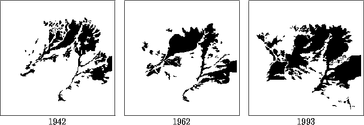
Aričge mountains called ``Soulane'' (table forest) to describe
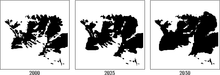
the evolution of its landscape for the years 2000, 2025 and 2050.
The figure 1 shows the maps
obtained from the aerial photographs taken through time. These maps show
the changing scene within the region area over a period of just over 50
years, with snapshot recorded at three times: 1942, 1963, 1993 in ( ![]() ) pixels (figure 1).
) pixels (figure 1).
From these maps, we can get the progression and regression zones between each two instants of time. We can calculate the coefficient of evolution for each pixel of the image considering the parameters mentioned previously. Then, the coefficient obtained from the out-image data and the expert knowledge can be integrated.
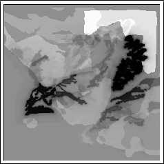
We have also used an evolution image
(figure below) where more a pixel is dark more it is favorable for
the progression. The predict maps for the years 2000, 2025 and 2050 obtained
by means ![]() -level sets for the years are shown in figure 2.
The range of altitude represented in the map is defined from 500 m to 2100
m. In this case, with regard to the altitude, there is no change in vegetation
over 1700 m according to an expert in geography.
-level sets for the years are shown in figure 2.
The range of altitude represented in the map is defined from 500 m to 2100
m. In this case, with regard to the altitude, there is no change in vegetation
over 1700 m according to an expert in geography.
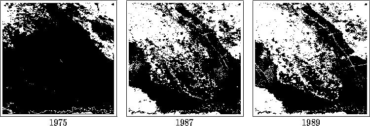
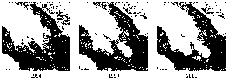
In a second approach, this method is applied to a region located in a tropical rain country: the oriental piedmont of Andes Mountain in Venezuela. This large area is typical of tropical deforestation in a pioneer front. The evolution of its landscape is described for the years 1994, 1999 and 2001.
Many maps about deforestation from 1975 to 1987, 1987 to 1989, 1989 to 1995 or from 1975 to 1994 are created from multispectral processing. Each map shows different steps or the chronology of the deforestation between two dates. A ground control allowed results got on this pioneer front to be verified.
Geographical maps are satellite images showing the changing scene within the region area with snapshot recorded and changed in black and white in three times: 1975, 1987, 1989. Each map shows a new legend more simple: forest, pasture and deforestation. The years 1975, 1987, 1989 and 1994 correspond to the image acquisition.
The experimental tests have shown promising results. The predict maps for the years (2000, 2025 and 2050) are shown below.