GEODES
ARCHITECTURE

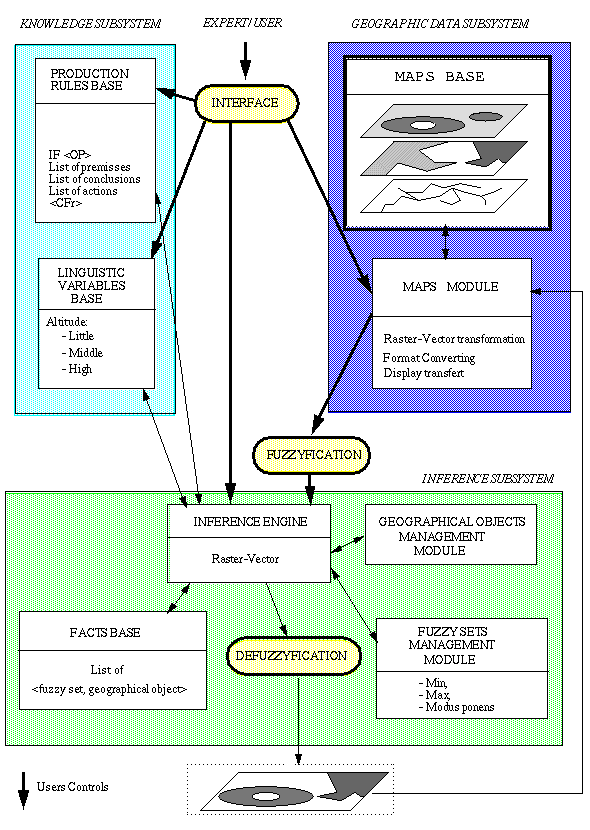
Our system consists of four subsystems (figure 1):
- a geographic data subsystem for acquiring, converting, transferring
and displaying maps,
- a knowledge subsystem to store knowledge in the rules base and
the linguistic base,
- an inference subsystem to generate new maps by using
- all the bases,
- the fuzzy inference engine and
- specific modules,
- an interface to control knowledge acquisition, maps management
and inference process (fuzzyfication, inference, defuzzyfication, storage)
with a formal language using key words.
Figure
1: Architecture of GEODES.


IRIT-UPS


![]()
![]()
