 |
 |
Application:
Geographic Features Extraction by use of Satellite Images and
Vectored Imprecise Databases
![]()
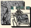
We describe here a system able to identify cartographic objects on SPOT
images using prior vectored geographic databases, and to modify these databases
(precision and updating) [P. Dhérété,
1998]. Prior data and expert knowledge are used to help image analysis.
Moreover imprecision of information sources is taken into account by fuzzy
logic approaches.