|
Products & Examples
The reason for developing the four planned products is to aid the customers in their daily tasks of fire prevention and management in the following ways:
End users have available daily the forest fire risk maps, covering their national territory (15 June-15 September). Fire risk maps contain fire risk indices developed according to the MEGAFiReS methodology, adapted to the CFS near real time constraints. The purpose of this product is to improve the present planning, organisation and co-ordination of forest fire Authorities.
This product is generated from NOAA-AVHRR channel 3 data, from late evening and night satellite passes for all countries concerned. The methodology and fire detection procedures are adapted from the MEGAFiReS project. The purpose of this product is to cover for the existing lack of data, in the absence of traditional forest fire watch system during the night hours.
This product shows the evolution of active perimeters of burning areas obtained from all useful NOAA-AVHRR passes. This product is centred over the Iberian Peninsula and, optionally, southern France.
This product includes the creation of a specific Web information site, as the technical solution for making the previous products available to end users in near real time.
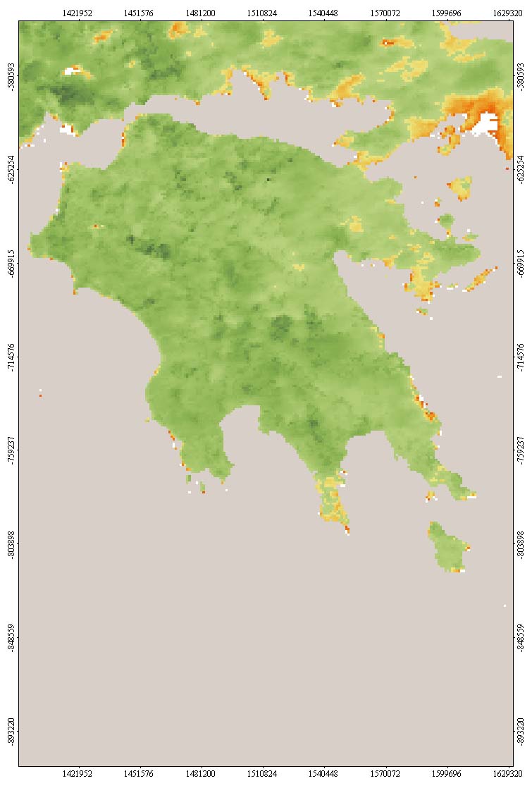
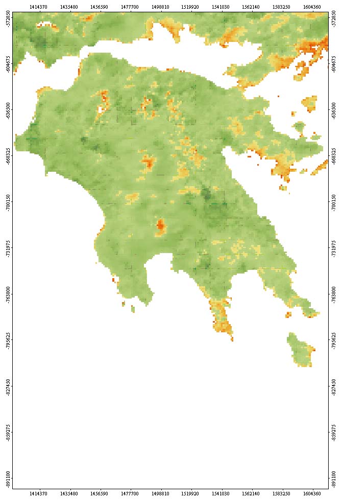
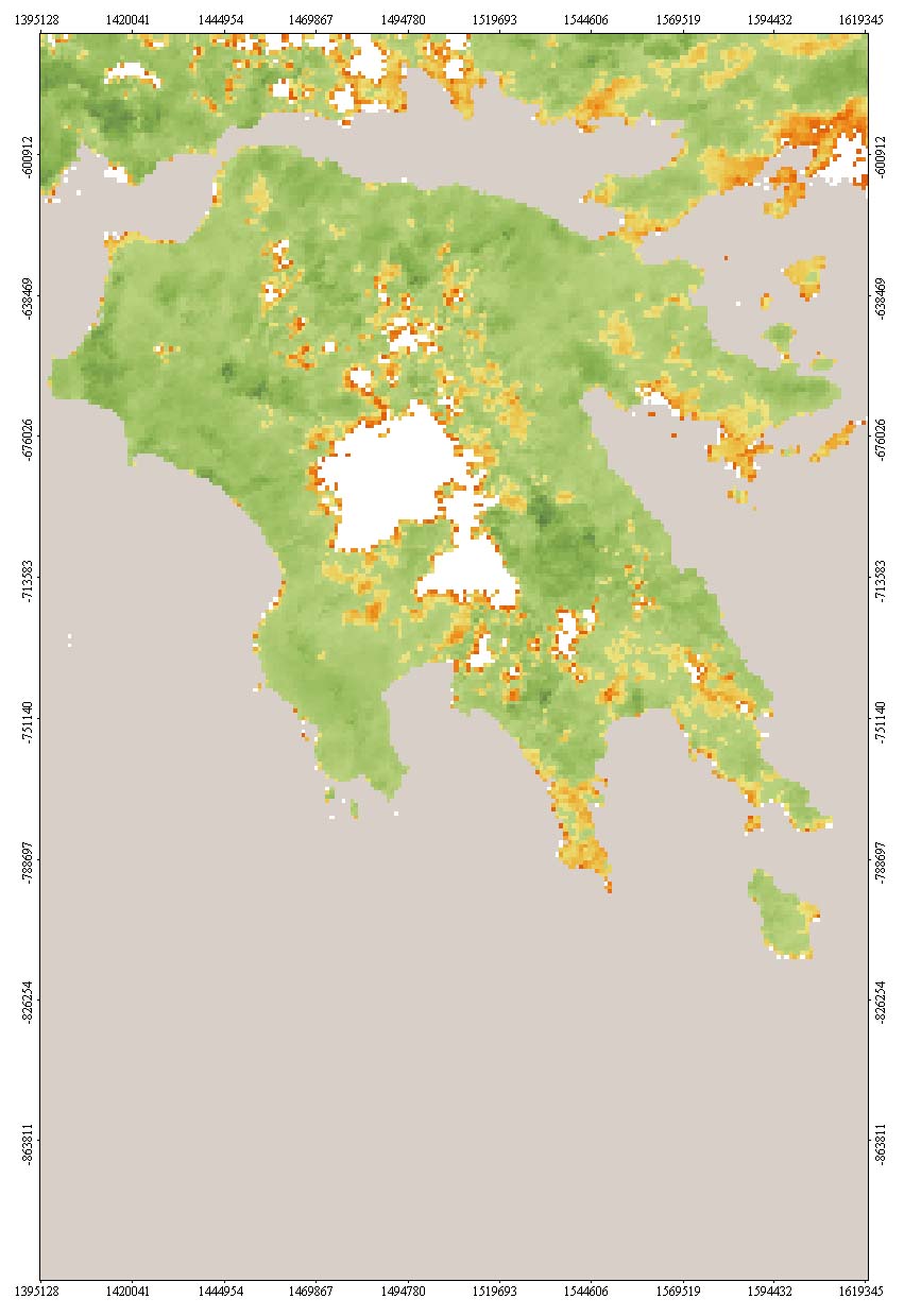
In the following, examples of product 1 (Daily fire risk maps) are given for certain dates for the area of Peloponessos in Greece.
26/6/1999 |
 8/7/1999 |
11/7/1999 |
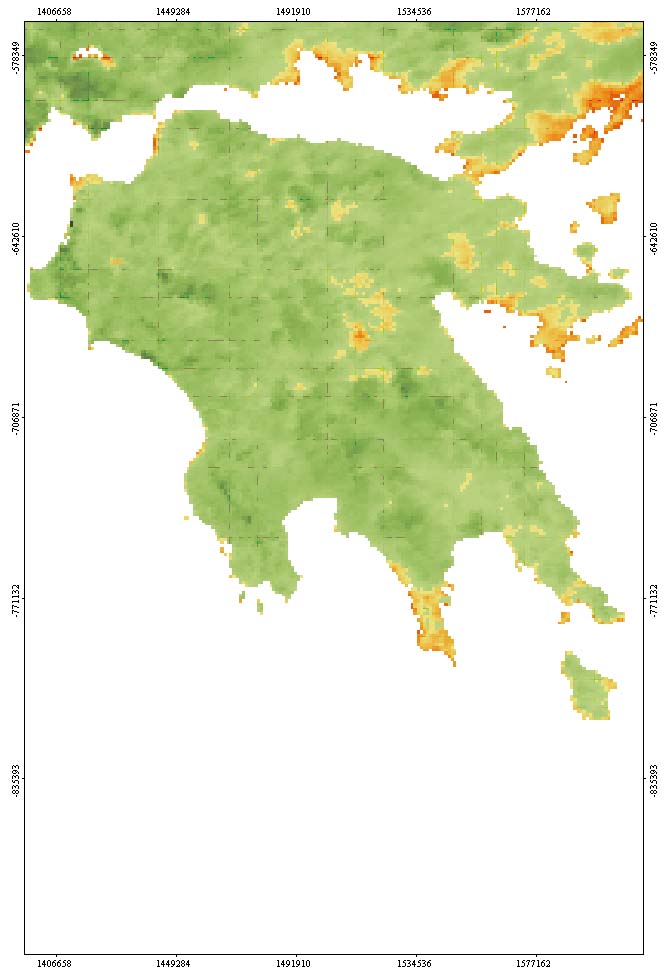 17/7/1999 |
Samples of daily fire risk maps for Peloponesus (Greece)
Source: KTIMATOLOGIO S.A., Greece (CFS Project, http://www.ktimatologio.gr)
|