|
|
|
|
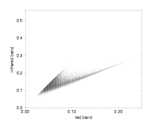
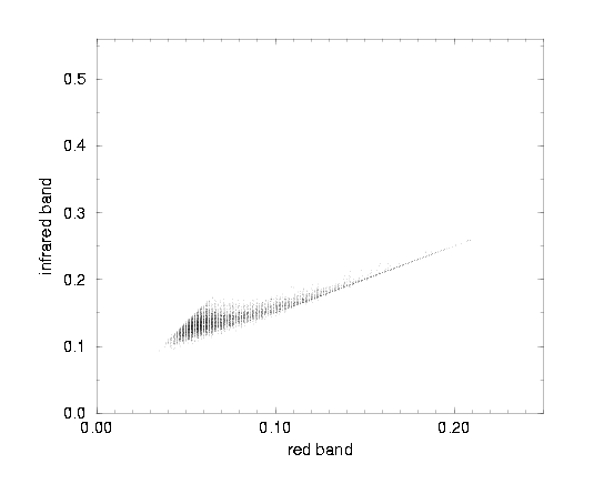
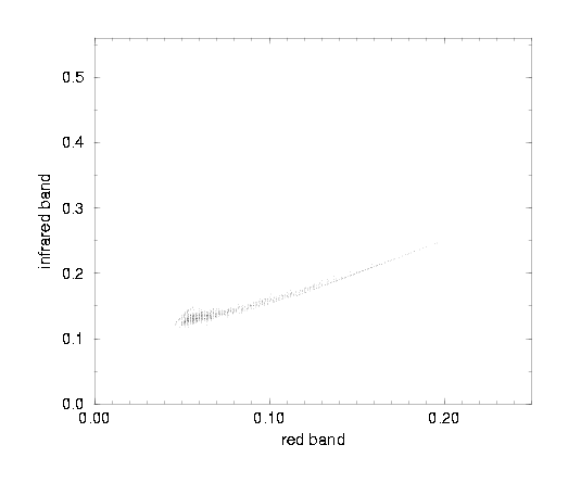
Each of the above images is a 2-band image, with bands red and infrared. The scattergrams below show the distribution of all pixels from all the images of the same resolution. A characteristic triangular shape is formed with one side of the triangle being created by the pure soil pixels (the "soil line"), and the other by the pure vegetation pixels. The position of a pixel inside such a scattergram and its distance from the so called "soil line" is used to assess the amount of vegetation the pixel contains. |
|
pixels: 5 x 5 m2
|
|
|
|
pixels: 10 x 10m2
|
|
|
|
pixels: 25 x 25 m2
|
|
|
|
|
|