Lineaments detection was performed by the analyst on screen. The software
package allows easy manipulation of the image, like zooming and image rotation which
avoids introducing a directional bias.
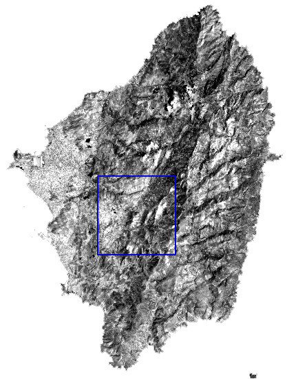
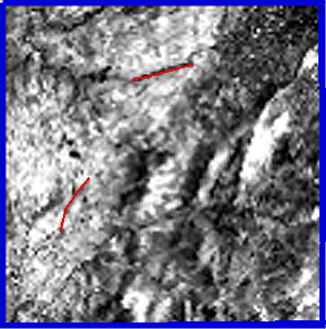
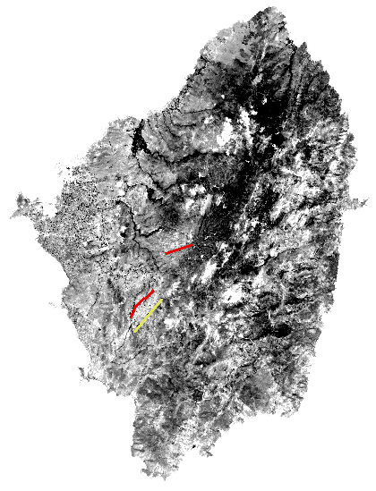
Lineaments that were interpreted by the analyst as being of geological
and geomorphological origin, were extracted from 17 enhanced images, the 6 contrast
stretched TM reflected bands, the ratios 3/2, 1/2, 4/3, 4/2 and 4/7 and also the 6
principal components.
The first set of lines were identified on contrast stretched TM
band 5. The file produced was overlain on the second image, where more lineaments
were detected and so on until a complete map of lineaments was produced. This map was then
screened to remove man-made lineaments like roads.
|