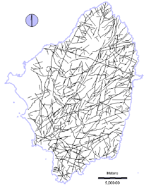
The total lineaments (335)
interpreted as possibly being of geological and geomorphological origin, visible on the
Landsat TM image of Naxos of the 19th of July 1989 and the enhanced images produced
with the application of Photointerpretation, Remote Sensing methodology and Digital Image
Processing techniques.