The remote sensed lineaments were analyzed for spatial density,
frequency, orientation, relative entropy and angular atypicality using a computer program
developed by the research team.
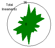
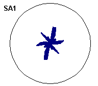
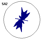
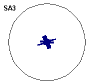
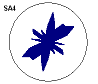
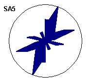
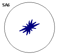
The results were presented as tables, histograms and rose diagrams for
the whole of the study area and for each specified cell of a grid dividing the island into
ten sub areas.
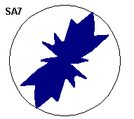
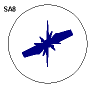
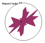
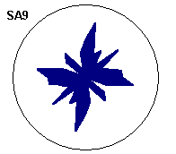
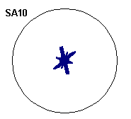
Rose diagrams were generated by depicting the directional frequency or
the length of linear features per directional class, each of which had an interval of 100
.
This allowed the analyst to identify the main trends.
The other two properties measured, relative entropy and angular
atypicality are related to the spatial distribution of the data and are useful in
determining whether the lineaments are aligned to a regional pattern or are random in
their distribution. This is important when trying to assess whether groundwater flow is
along preferred pathways defined by major tectonic features or whether a high yield is
related to the interconnectedness of a number of randomly orientated fractures.