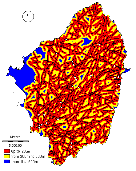
From the analysis of the data of remotely sensed
lineaments detected on TM images, the following map was produced to guide in the
selection of sites for further investigation in a groundwater exploration. Successful
boreholes with reliable productivities can be expected to occur in areas (shown in red)
closer to lineaments (shown in black).
The white dots on the map are the sites of boreholes, from
the borehole data collected for the needs of the research. Boreholes with high yields are
found in the favourable zone (up to 200m away from a remote sensed lineament).