Data & Methodology
Field operations were carried out, for all the study areas, by the National Agricultural
Research Foundation of Greece (Institute for Forest Research). During these field
operations, the values of the necessary factors that contribute to soil erosion and
natural regeneration processes were measured for 39 training and 14 test sites. The
National Agricultural Research Foundation, being the forestry expert, also provided the
rules that determine the natural regeneration potential, the risk for soil erosion and the
desertification risk of a certain area, after a forest fire. According to these rules,
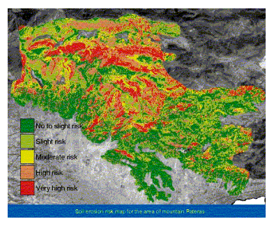
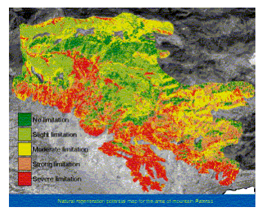
natural regeneration potential is a function of soil depth and aspect, while risk of
erosion is given as a function of surface geology, soil depth and slope. Desertification
risk is considered as the sum of the natural regeneration potential and the risk for soil
erosion. [Nakos G., 1993]
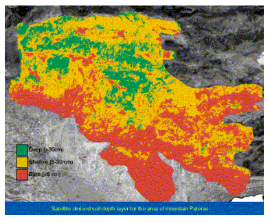
As an example, the following maps illustrate: a satellite derived soil depth layer of
mountain Pateras, an erosion risk map, as well as a natural regeneration potential map of
the same mountain.
|